Capture Reality.
Down to the pixel.
Specialized in Airborne LiDAR, High-Res Bathymetry, and Photorealistic Gaussian Splatting for engineering and simulation.
LIDAR
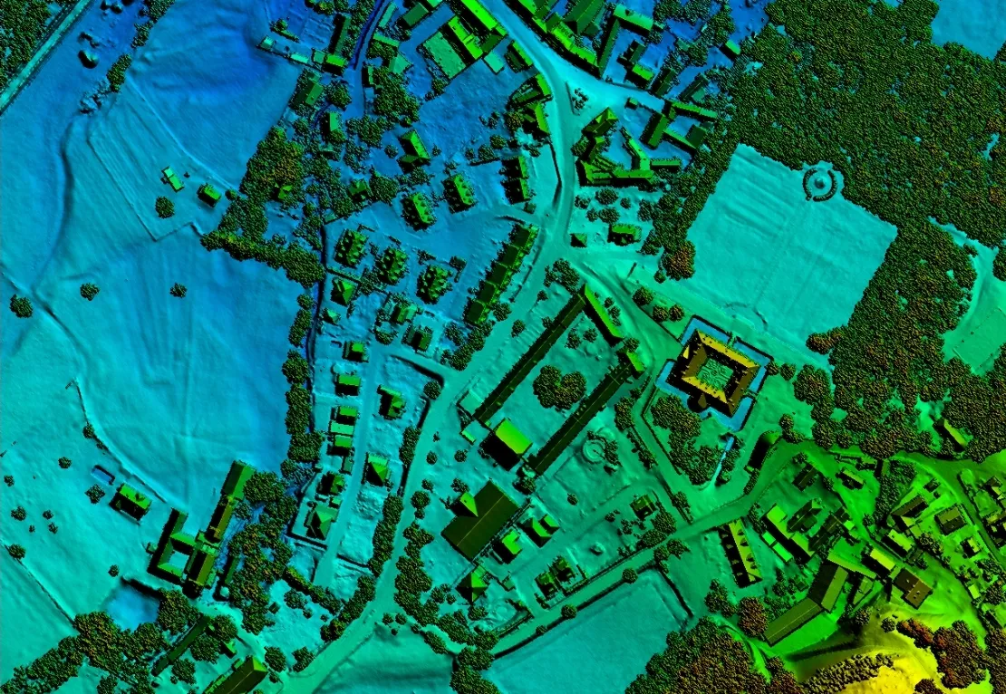
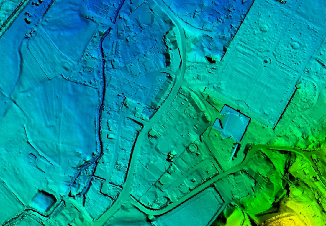
We deliver classified point clouds with extreme density. From forestry management to infrastructure monitoring, our data integrates seamlessly into your GIS workflow.
- 20+ points / m² density
- Full waveform analysis
- DTM & DSM generation
Large-scale LiDAR & Orthophoto acquisition for European power grid expansion and corridor planning.
BATHYMETRY
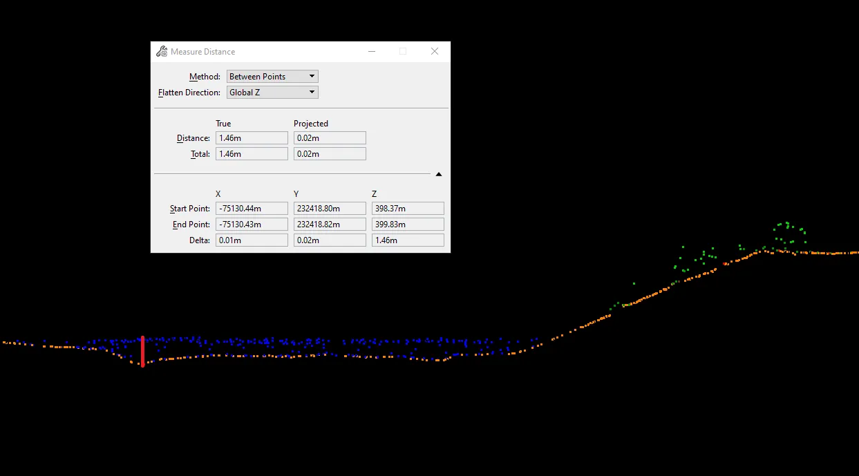
Using green-wavelength laser technology, we map the underwater topography of rivers and lakes. Seamlessly merging land and water data into a single mesh.
Providing specialized expertise in bathymetric LiDAR for riverbed modeling and underwater object identification.
PHOTOGRAMMETRY
Precision Digital Twins and Asset Monitoring. We deliver high-resolution 3D meshes and 3D Tiles for large-scale industrial infrastructure, refineries, and heritage sites, georeferenced to sub-centimeter accuracy.
- Sub-centimeter accuracy & Georeferencing
- High-fidelity 3D Reconstruction
- Seamless Web Integration (3D Tiles)
Complete spatial reconstruction of complex industrial plants for planning, maintenance, and virtual site visits.
GAUSSIAN SPLATTING
Achieving photorealistic details through state-of-the-art volumetric representation. This model was created using a nadir only dataset out of a helicopter, achieving around 5cm resolution.
- Helicopter-based acquisition
- Nadir-only image capture
- ~5cm spatial resolution
Real-time exploration of photorealistic scenes directly in your browser.
OPEN ADVANCED SPLAT EDITORORTHOPHOTO
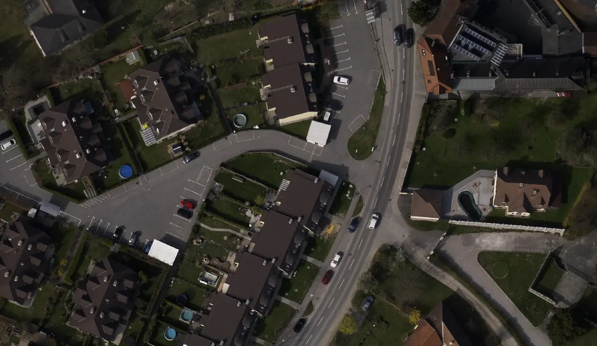
We produce highly accurate, orthorectified aerial imagery with uniform scale and precise map projections. Unlike raw aerial photographs, our orthophotos are fully corrected for topographic relief, lens distortion, and camera tilt.
- Absolute geometric accuracy for measurements
- Seamless GIS and CAD integration
- Up to 3cm Ground Sample Distance (GSD)
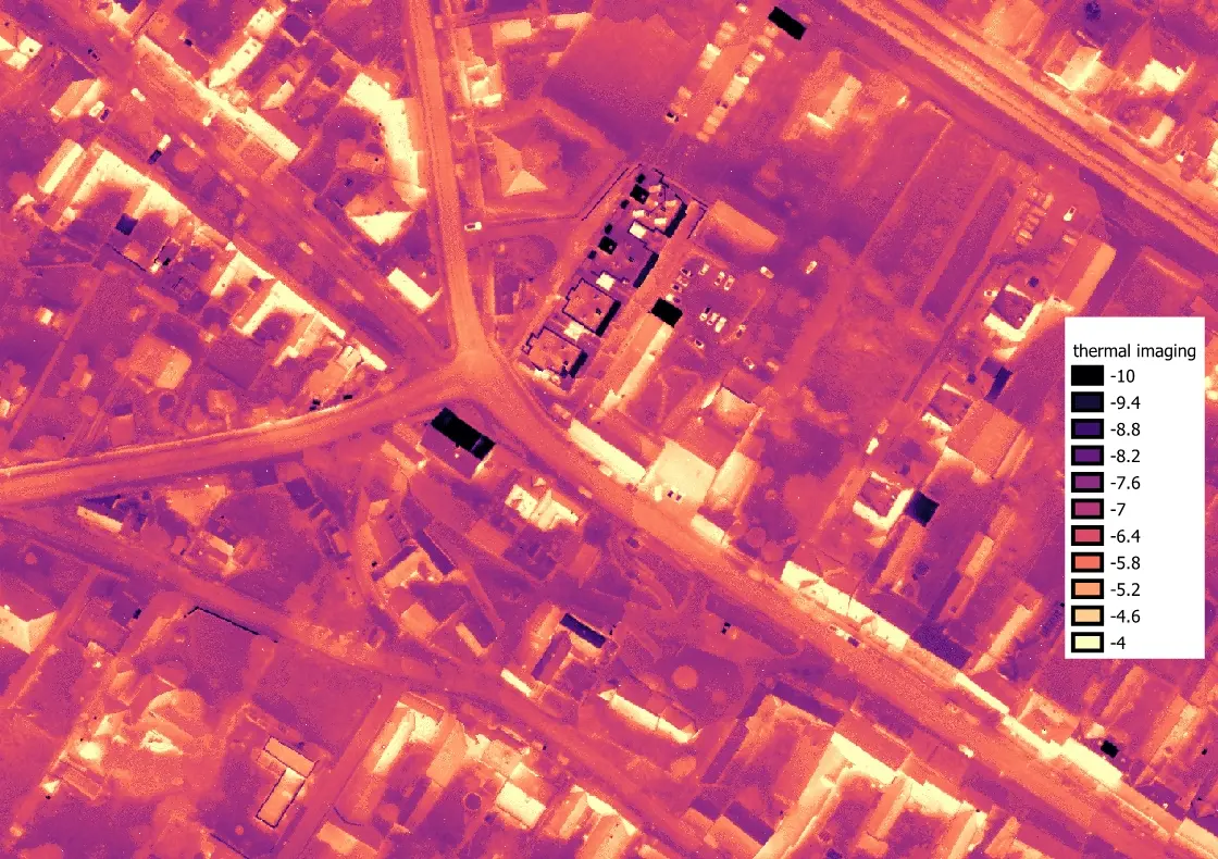
THERMAL IMAGING
Our advanced thermal imaging sensors detect long-infrared radiation (9–14 µm) to reveal thermal signatures completely invisible to the naked eye. By capturing precise temperature distributions across large geographical areas, our radiometric thermal orthophotos enable critical applications.
- District heating leak detection
- Sub-surface pipeline monitoring
- Night-time / zero-illumination operability
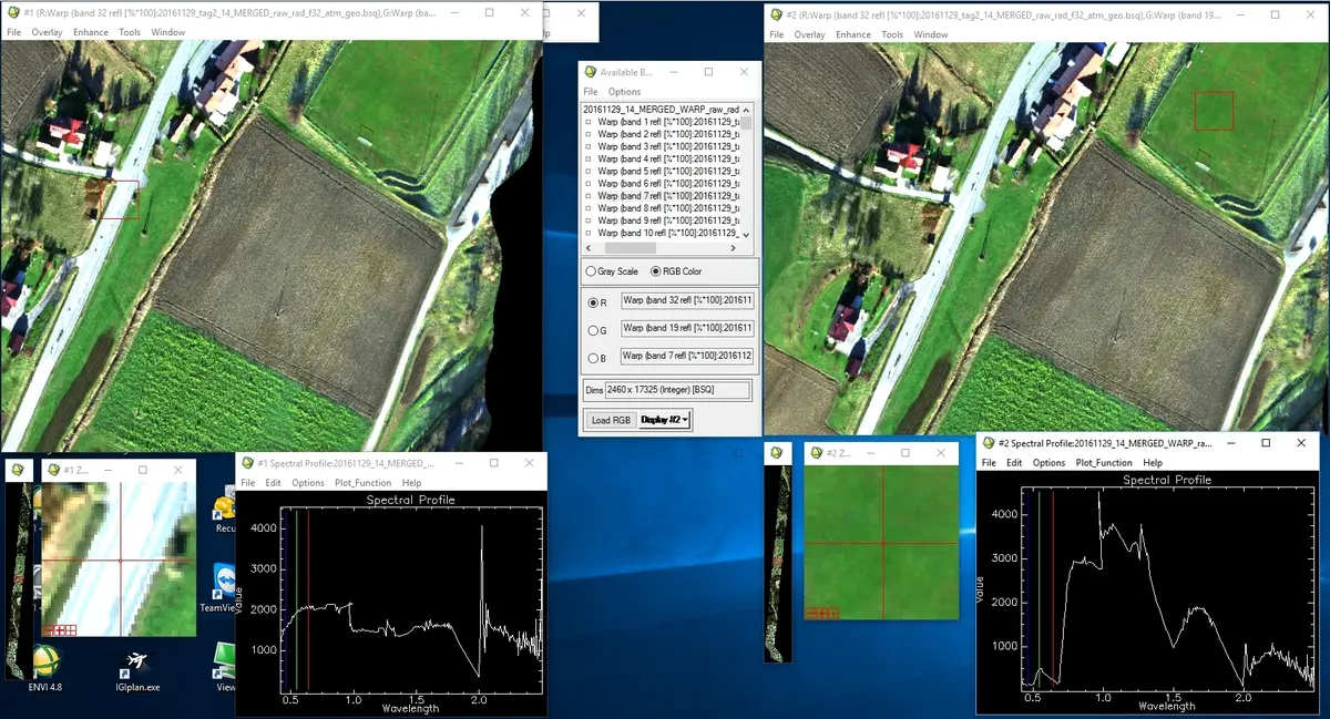
HYPERSPECTRAL IMAGING
Capturing continuous spectral information across hundreds of narrow bands, our hyperspectral workflows provide detailed biochemical and physical insights. We deliver atmospherically corrected (VNIR/SWIR) data cubes that allow for precise material identification.
- High-fidelity spectrum per pixel
- Vegetation health & agricultural analysis
- Environmental monitoring & mineral mapping
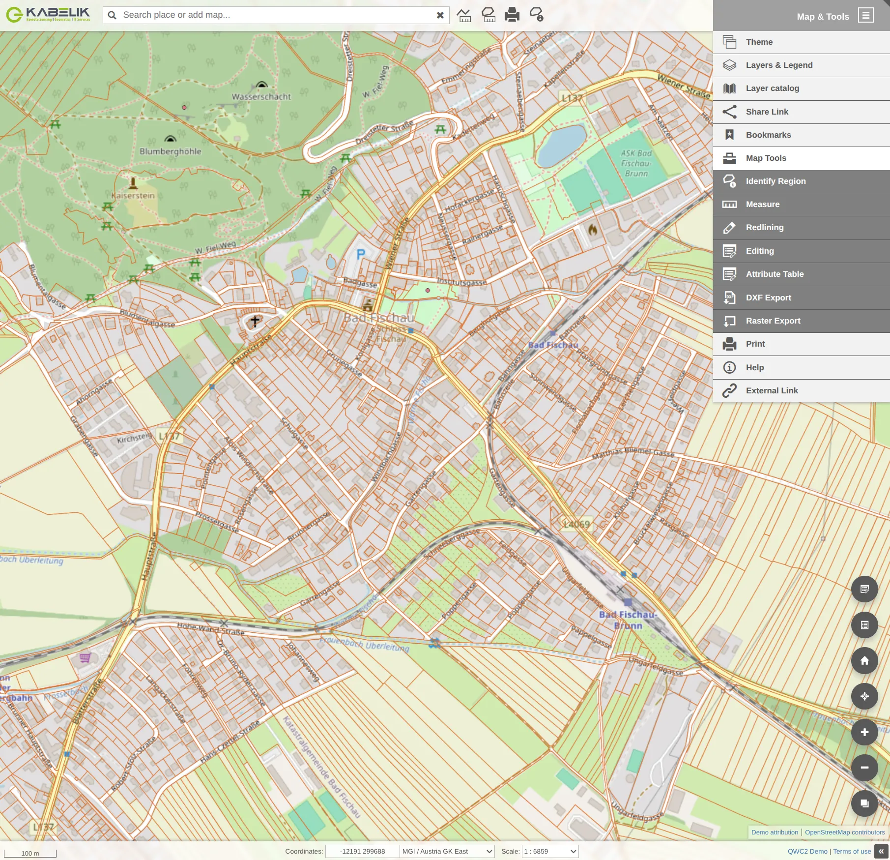
WEB/GIS
Custom Geoinformation data handling, conversion and enterprise management. We architect high-performance Spatial Data Infrastructures for seamless data access and mobile field workflows.
-
GeoNode SDI Stack
Enterprise spatial catalog for mapping, sharing, and securely managing vector and raster datasets.
-
GeoServer & QGIS Server
High-performance rendering engines providing standardized OGC-compliant WMS and WFS web services.
-
Mergin Maps Server
Enabling collaborative field data collection natively synchronized with central enterprise databases.
-
QWC2 Integrated Dashboards
Custom QGIS Web Client 2 implementations for deeply interactive web mapping applications and analysis tools.
IT SERVICES
Professional IT infrastructure specialized in Linux, Mergin, Postgres (PostGIS), and QGIS Server ecosystems. We also provide comprehensive Windows administration and support.
- Linux (Debian/Ubuntu) & Windows Expert
- Scalable Cloud Infrastructure (Nginx/Docker)
- Enterprise Architecture & 24/7 Operations
SELECTED CASE STUDIES
Power Corridor Monitoring
Operational LiDAR and Orthophoto campaigns for major European power transmission networks.
Aerial Infrastructure Thermography
Large-scale thermal monitoring of pipeline networks and industrial assets for anomaly detection.
Bathymetric Mine Detection
Expert consulting and R&D for underwater target identification through LiDAR bathymetry.
Industrial Facility Digital Twin
Generation of high-precision 3D meshes and Gaussian Splats for petrochemical complex management.
Fiber-Optic GIS Transformation
Transition of legacy GIS landscapes to high-performance Open-Source stacks based on PostGIS.
Riverbed & Sediment Analysis
Merging terrestrial and bathymetric data for seamless terrain modeling and water management.
KABELIK GMBH
"Bridging the gap between operational aviation experience and cutting-edge Geoinformatics."
Organizational Core
Professional Remote Sensing, Geomatics, and IT Infrastructure.
Kabelik GmbH is a specialized provider of high-end geospatial services and complex IT infrastructure solutions. Based in Wiener Neustadt, we operate at the intersection of aerial data acquisition and advanced data processing.
Our focus lies on the entire value chain of remote sensing: from the strategic planning and execution of sensor missions to the high-performance processing and refinement of massive datasets into actionable Business Intelligence. We support industrial partners and utility providers in managing complex spatial data—efficiently, scalably, and at the highest technological level.
Service Philosophy
Integrating flight operations with data analysis to ensure zero-loss information transfer.
Developing scalable, vendor-independent stacks based on QGIS, PostGIS, and Linux.
Providing enterprise-grade IT environments for critical geospatial data processing.
Certifications & Expertise
Deep expertise in LiDAR stripping, refraction correction, and multi-sensor fusion.
Systemic approach to ITIL standards, cloud architecture, and data security.
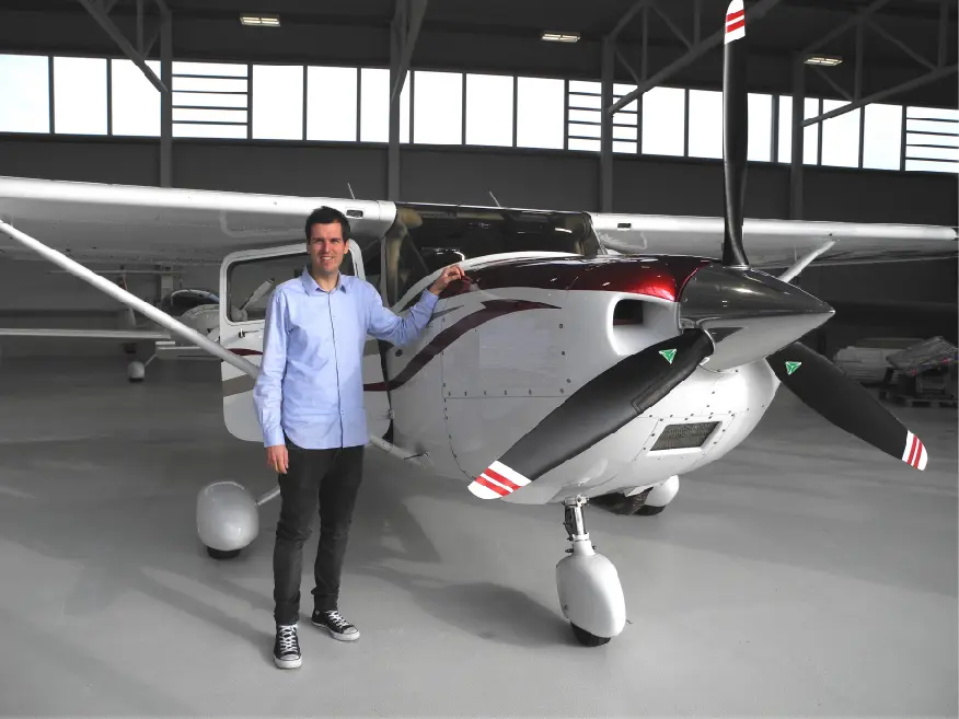
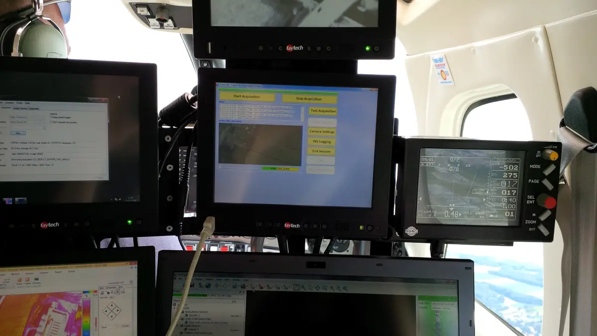
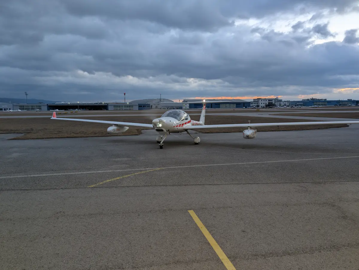
AERIAL OPERATIONS & IMPRESSIONS